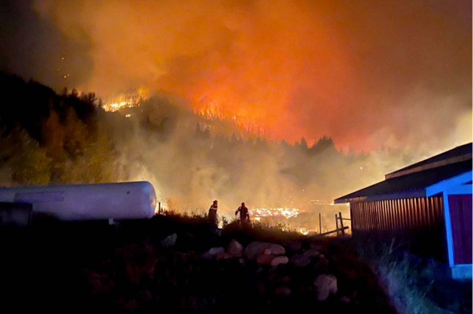
A new study targeting the Thompson-Okanagan as susceptible to losing hundreds of millions annually from new homes being built in high-risk areas.
The Canadian Climate Institute's new report, titled Close to Home: How to Build More Housing in a Changing Climate, states that across Canada, 92 per cent of wildfire losses to new homes will be concentrated in just 20 municipalities, with seven of those communities in the Okanagan.
"Average annual losses to new homes in the Thompson-Okanagan are projected to be $690 million," says an Okanagan Water Basin Board review of the study provided by water science specialist Sandra Schira.
"The Thompson-Okanagan was also shown to be at risk of significant flood damage to new homes."
In the Canadian Climate Institute report, researchers modelled the risk across Canada to new homes built by 2030, from flooding and fire damage.
Using current land-use policy and development plans, the report concluded that in B.C. many new homes will likely be built in high-risk areas, with these homes predicted to incur significant costs and greatly impact housing affordability if built.
"The financial risk from new housing in flood and wildfire hazard zones could surpass $2 billion per year in B.C., with some areas facing losses in the hundreds of millions annually," states the report.
While the report makes reference to specific numbers of municipalities in a given region, it does not identify them, instead, it presents statistical data largely from a province-wide perspective.
Schira notes that the study points out, that most of these projected costs can be avoided with the implementation of sound policy.
"One of the report's most significant findings was that a tiny percentage of new homes built in the most high-risk areas would account for most costs," she stated.
"For example, in the Thompson-Okanagan, 2 per cent of new homes built in the areas with the highest flood risk will comprise 70 per cent of the cost of flood damage to new homes.
"Therefore, preventing a small number of extremely risky developments will allow the Okanagan to meet housing needs without needlessly adding to the issue of housing affordability."
The Canadian Climate Institute researchers call on municipalities to think beyond typical municipal costs such as water, wastewater and transportation infrastructure, but also potential ongoing costs such as future insurance premiums or disaster risks in extreme weather event high-hazard building zones.
"In other words, a home in a high-hazard area that incurs damage and must be repaired or replaced, is subject to increasing insurance premiums, will prove far less affordable than its purchase price or rental rate might convey," states the report.
"Similarly, infrastructure expansion that encourages further development in a hazardous area creates significant society-wide costs beyond the initial capital cost of the project."
The report also cites flood and wildfire mapping across Canada as inadequate, with flood hazard maps often outdated or entirely unavailable for large parts of the country and wildfire hazard mapping lagging even further behind.
"The lack of comprehensive hazards information forces provincial and municipal governments to make critical housing development decisions based on incomplete and inaccurate data," says the report.
An exception to that conclusion is in the Okanagan where the Okanagan Basin Water Board (OBWB) initiated a technology called LiDAR to create digital three-dimensional aerial imaging data to accurately map the Okanagan Lake foreshore landscape.
OBWB executive director Anna Warwick Sears has said the LiDAR data will be valuable to community planners and decision-makers in local government and First Nation communities where building should and should not be allowed from flood protection and prevention perspectives.
This project was supported by a provincial grant of $1.45 million.


