The higher than average snowpack buildup across the valley so far this winter would normally be a leading indicator for controlling the level of Okanagan Lake.
But after the extreme changes in last year’s winter and spring weather conditions, Shaun Reimer says extreme weather patterns is raising unknowns about managing the lake level.
As the section head for public safety and protection at the regional office for the provincial Ministry of Forest, Lands, Natural Resource Operations and Rural Development, Reimer is in charge of releasing water from Okanagan Lake at the Penticton dam.
“The shadow hanging over us right now is not from what happened last year, but rather climate change and the lack of understanding about where that is going to lead in causing extreme weather pattern changes,” said Reimer.
Related: Climate change impacts Okanagan Lake
“We have computer charts that dictate how to react to more snowpack years or drought years in that regard. But we certainly didn’t expect those conditions to happen in the same year. That has been the radical change.”
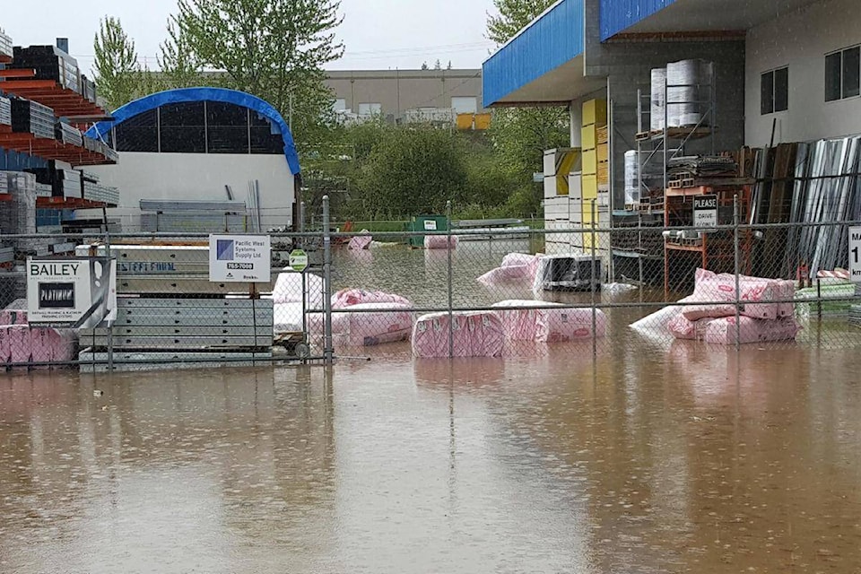
That radical change was evident from the fall of 2016 through to the spring—heavy precipitation from October into December, low snowfall accumulation from January to March, then intense snowfall followed by record rainfall from March to May.
The end result was widespread flooding across the valley, costing millions of dollars for communities and property owners in damages.
Related: �鶹��ѡ mayor frustrated by residents’ climate change message
“It felt like someone was turning the light switch on and off the way the weather patterns were suddenly changing,” he said.
Reimer said the dam release schedule has been raised from 28 to 30 cubic metres/second, the maximum allowed that won’t damage the current Okanagan River sockeye salmon spawning run. He said the lake is being drawn down now in anticipation of the current snowpack melt, which currently is more than 130 per cent of normal.
“The aim now is to make room for that snowmelt the way we are heading at this point. The level of precipitation in May and June, which is normally our heavier rain months, is the wild card factor in the melting pattern of the snow,” said Reimer.
Last year, record high precipitation in the early spring caused a cavalcade of snowmelt water flow because the rain caused the snow to melt more quickly, coupled with a rising groundwater table already too saturated to off-set the sudden surge of water.
“Normally, our high water discharge rate is 60 cubic metres a second, and we got close to 80 at one point because of the flooding issues. But we don’t normally want to exceed 60 because that causes further flooding downstream because there isn’t the natural channel capacity to handle that kind of water flow,” Reimer said.
Related: West �鶹��ѡ demands review of flood factors
An internal review of how ministry staff addressed the extreme weather elements last spring leading up the flooding has been produced by a Vernon consulting firm. That report has been completed and is undergoing review within the ministry branches before being released to the public likely sometime in March.
To report a typo, email: edit@kelownacapnews.com.
<>@BarryGerding
barry.gerding@blackpress.ca
Like us on Facebook and follow us on Twitter.


